|
||
|
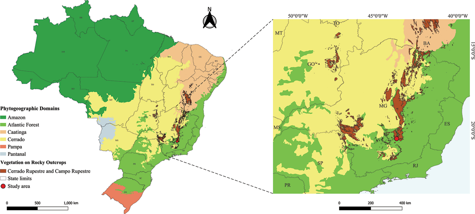
Map of the geographic location of the population of Zeyheria montana Mart. studied in the Cerrado Rupestre of Minas Gerais, Brazil. The boundaries of Brazilian phytogeographic domains were adapted from shapefiles available from the Instituto Brasileiro de Geografia e Estatística (2022) and the global ecoregions of Dinerstein et al. (2017). The vegetation on rocky outcrops is the combination of shapefiles from the rupestrian grasslands by Newton Barbosa and the iron outcrops of Serra dos Carajás in the State of Pará provided by Fernando Santos. Map design: Cássio Cardoso Pereira. |